
The United States Geological Survey Recorded a Magnitude 4.5 Earthquake at a depth of 63 km iabout 50 km to the northeast of the island of Martinique in the Lesses Antilles, at about 1.30 pm local time (about 6.30 pm GMT) on Thursday 1 October 2015. This event was felt across much of the island, though there are no reports of any damage or casualties; which is roughly what would be expected from an Earthquake of this size at this depth; the quake is big enough to be felt over a wide area, but most of its energy has dissipated before the shock-waves reach the surface.

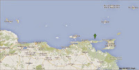
The approximate location of the 1 September 2015 Lesser Antilles Earthquake. Google Maps.
The Lesser Antilles are located at the eastern fringe of the Caribean Tectonic Plate. The Atlantic Plate is being subducted beneath this, and as it sinks into the Earth, is melted by the heat of the planets interior. Some of the melted material then rises up through the overlying Caribbean Plate as magma, fueling the volcanoes of the Lesser Antilles Volcanic Arc. The subduction of the Atlantic Plate beneath the Caribbean Plate is not a smooth process, with the two plates constantly sticking together then breaking apart as the tectonic pressure builds up, causing Earthquakes in the process, though since the boundary between the two plates is some way to the east of the islands, Earthquakes in the Lesser Antilles tend to be both deep and offshore, which lessens their destructive potential.

The subduction of the Atlantic Plate beneath the Caribbean Plate fuels the volcanos of the Lesser Antilles Volcanic Arc. George Pararas-Carayannis.
Witness accounts of Earthquakes can help geologists to understand these events, and the structures that cause them. The international non-profit organization Earthquake Report is interested in hearing from people who may have felt this event; if you felt this quake then you can report it to Earthquake Report here.
See also...
The United States Geological Survey recorded a Magnitude 5.2 Earthquake at a depth of 76.0 km roughly 15 km north of the the Paria Peninsula on the north...

The United States Geological Survey recorded a Magnitude 4.7 Earthquake at a depth of 20.8 km off the south coast of the Dominican Republic, slightly...

The United States Geological Survey recorded a Magnitude 4.8 Earthquake at a depth of 10 km in San Cristóbal Province in the southwest of the...
Follow Sciency Thoughts on Facebook.